:quality(70))
How Well Do You Know Jakarta?
An old story behind the scenes of the tutur visual interactive article creation in Kompas daily, themed on the 489th anniversary of DKI Jakarta.
Back in 2016, as Jakarta's 489th birthday approached, a Kompas editor mentioned they were planning to showcase old Jakarta photos by journalists on the Tutur Visual page. We then discussed how to present it to the readers.
When the editor suggested creating a photo slideshow, like we did when celebrating the 70th anniversary of the Republic of Indonesia, I feel less excited because the presentation will be one-way. I wanted users to interact with the content.
A year before The New York Time published an article about the geography test for taxi drivers in New York. They even linked it to a quiz page to test readers' knowledge about locations in New York.
We thought it would be a good idea to adapt the concept of the article, but this time users will chose the location on the map based on information from old photos. The editor was on board with the concept.
The next challenge was to convince the editor that this time Tutur Visual's content only consisted of a few large photos with short texts as hints to keep users focused on the quiz. One of the distinctive features of Kompas' Tutur Visual content was its long articles, which were usually unquestionable.
It turned out the editor approved the short texts and large images idea and asked us to keep the page including the introduction text and photo details.
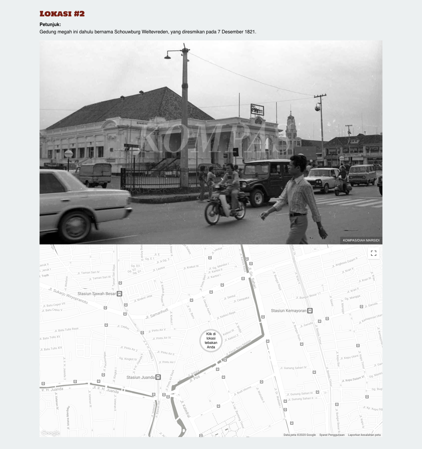
We set up a simple layout showing text instructions and old photos with photo credits. Below these elements, a Google map was displayed with instructions for users to click or tap on the location on the map. Detailed photo captions were only shown after users tap on the location on the map.
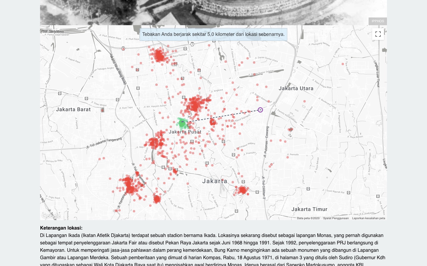
The next issue was not about the location coordinates since they were already provided, but about figuring out whether the user's chosen position fell within the right category or not.
We decided to use polygons as precise location markers. Their shapes were adjusted to match the top view of buildings or locations. If a user tapped on a location inside the polygon, the answer was considered correct. If not, a message would show how far off the selected location is from the polygon.
We also showed the history of other users' answers so everybody could see how well they knew locations in Jakarta based on clues from old photos.
This interactive article was published on June 21, 2016 at https://interaktif.kompas.id/hut_489_jakarta.
Like what you see?
I'm open to freelance projects and full-time roles. If you need someone who obsesses over structure and ships clean code — let's talk.